
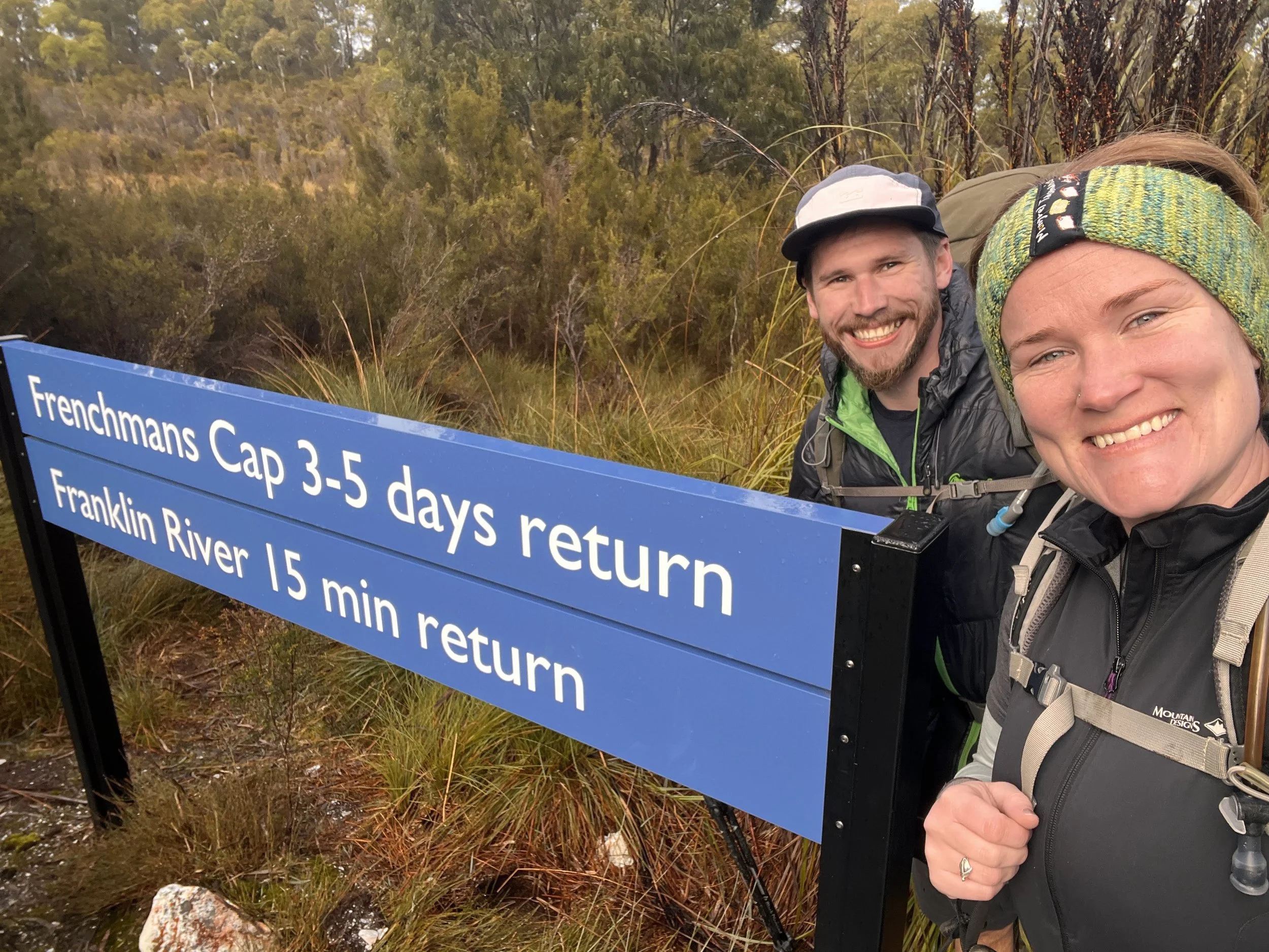
Day 1: Lyall Highway Trail Head to Lake Vera
After dropping off our fur baby to a friend in Deloraine we headed up to the Frenchman’s Cap trail head. We left at 6.30am and arrived at 9am.
We’ve been looking forward to hiking this trail for a while now. The last time Oscar had been through here he was about 6 years old and was swallowed entirely by the famed ‘Sodden Loddons’.
I never experienced the trail in those conditions having hiked it for the first time about 5 years ago, after the $1 million dollar donation Dick Smith gave to have the trail re-vamped and fixed up (thanks Dick!).
The sun was shining and off we set, hitting the trail at about 9.30am.
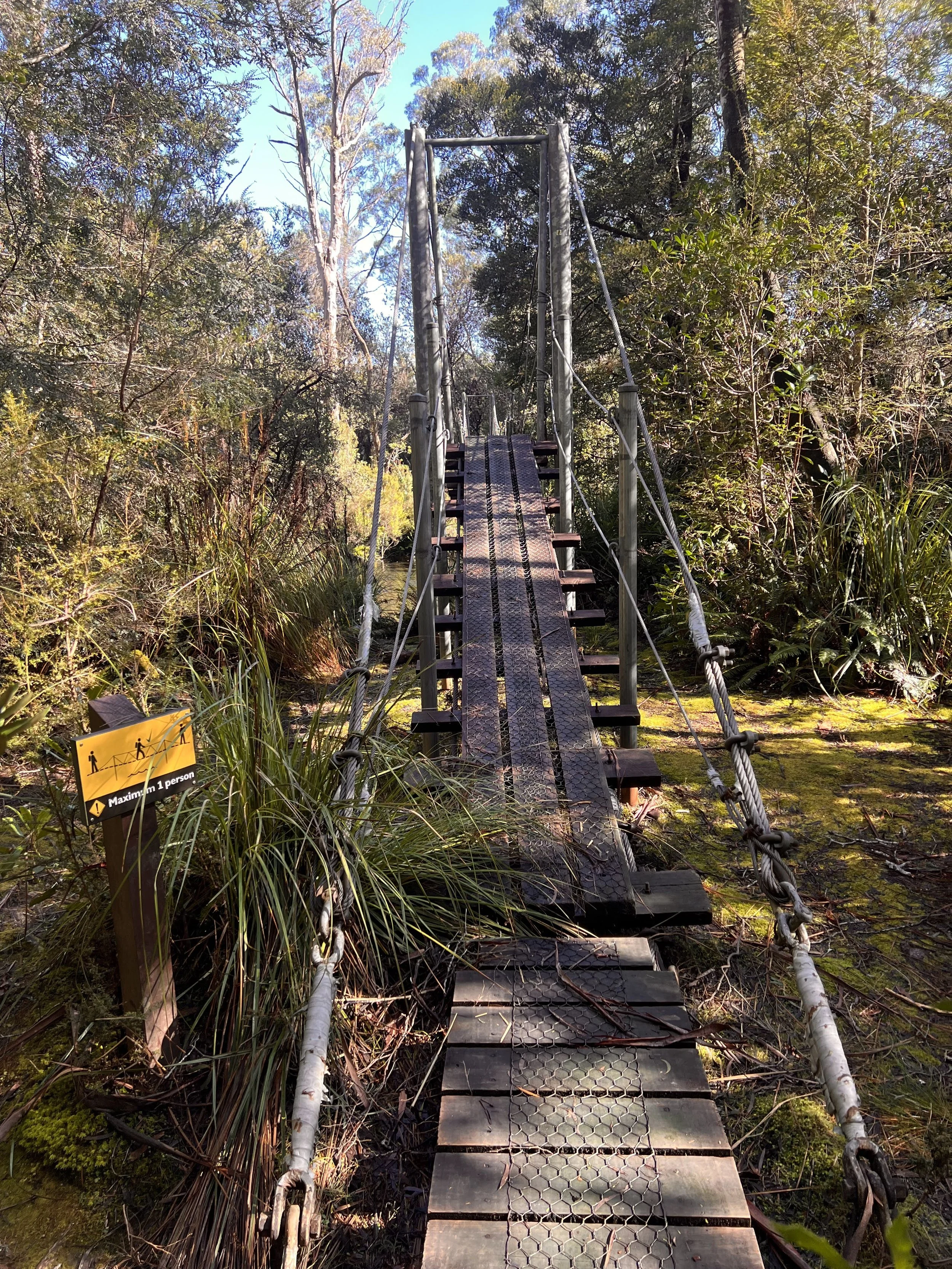
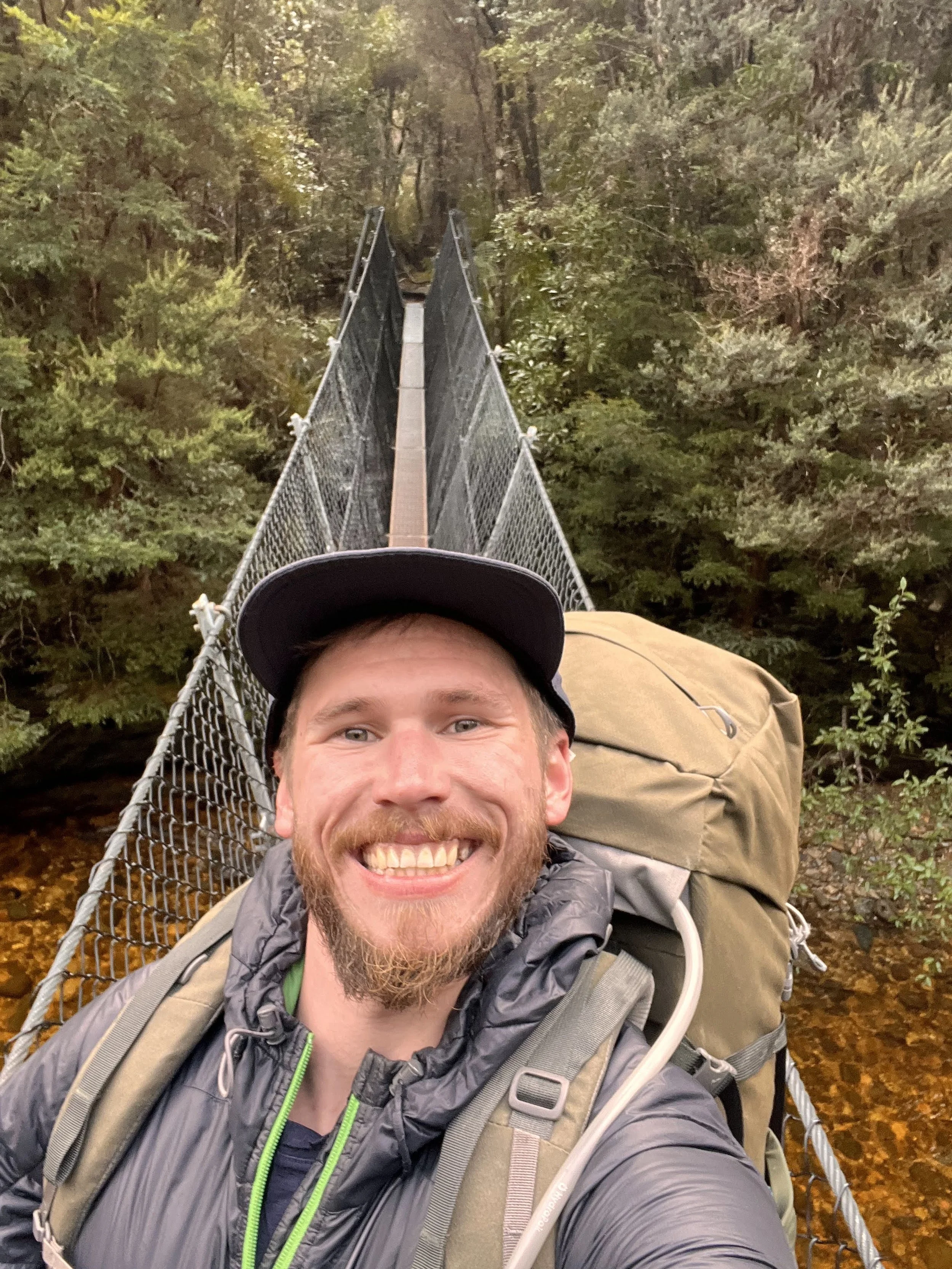
Within about 20 minutes we reached the mighty Franklin River – it wasn’t so long ago that the bridge across the Franklin was wiped out in some floods, which gives you such a great appreciation for the power of that river as you stand on the newly constructed bridge halfway across the river.
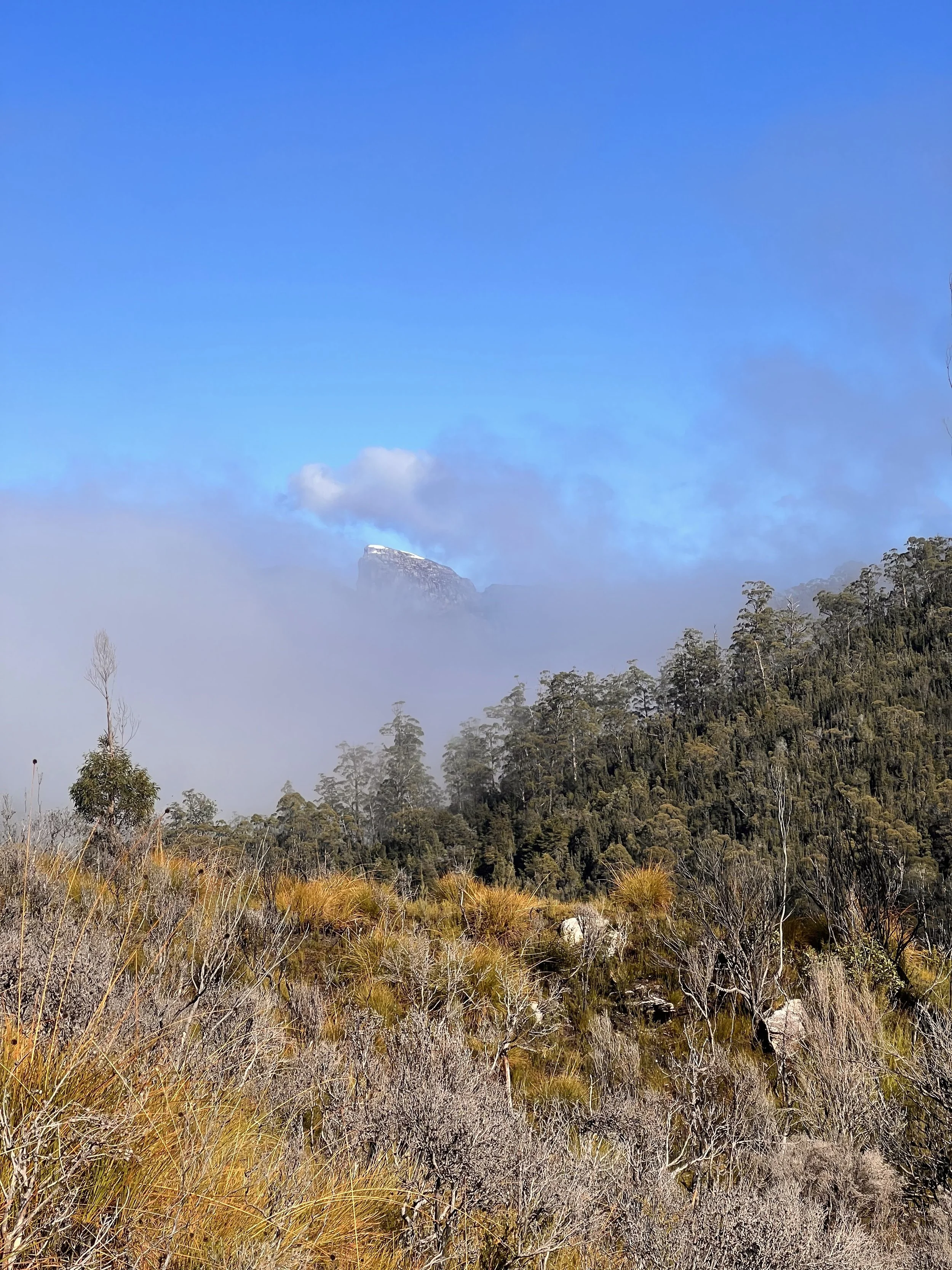
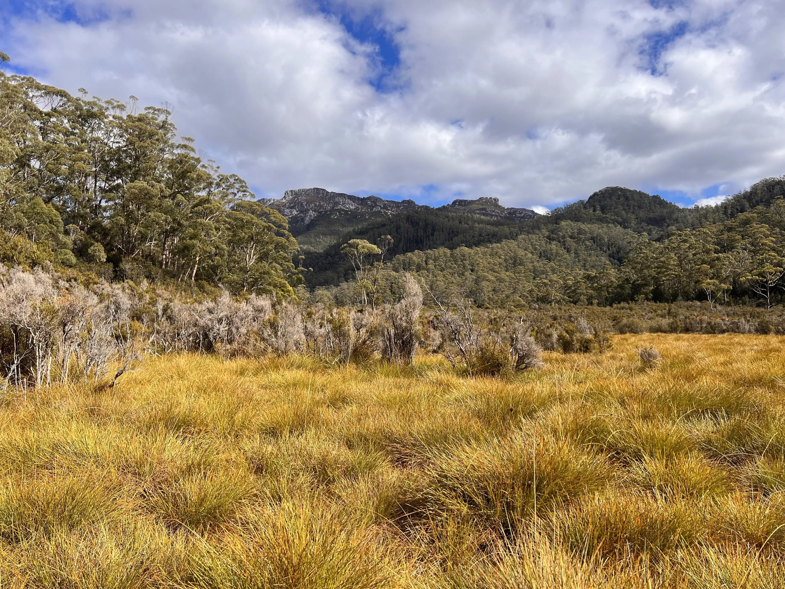
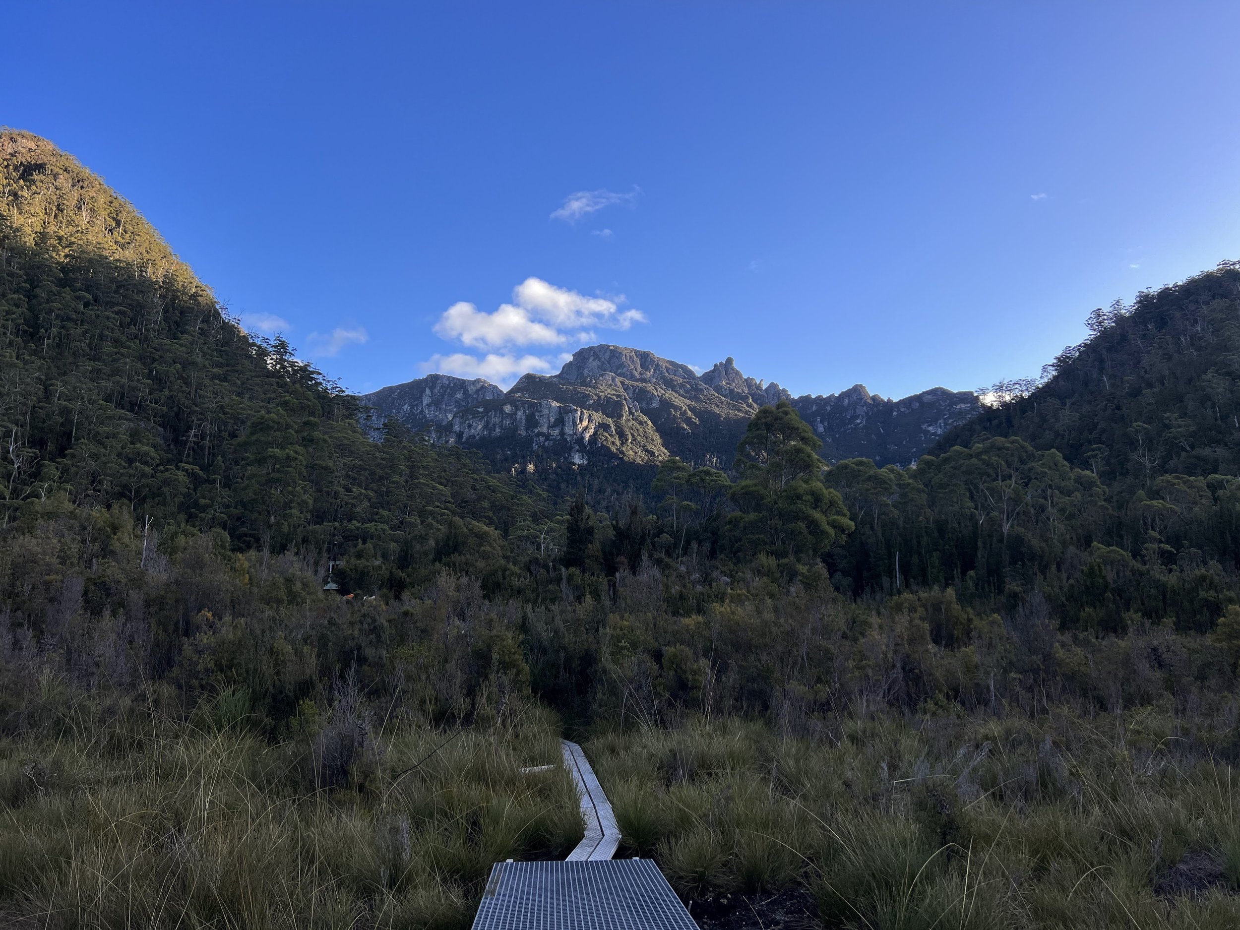
Continuing on through mixed forest vegetation, the landscape gently undulates and the trail pops in and out of clear button grass plains. It’s here that we are lucky to glimpse our first views of Frenchman’s Cap poking out between some clouds. It’s such an impressive looking mountain and to have views of it basically the whole way in is pretty cool!
2 hours in to the hike we cross the Loddon river. There are campsites on the Southern bank of the river, once you cross over the bridge. We stop for a quick snack break and a couple of pink wrens come out to play.
For about an hour the trail continues on in a similar fashion, dipping in and out of mixed forest with the Pickaxe Range out to the right coming into view.
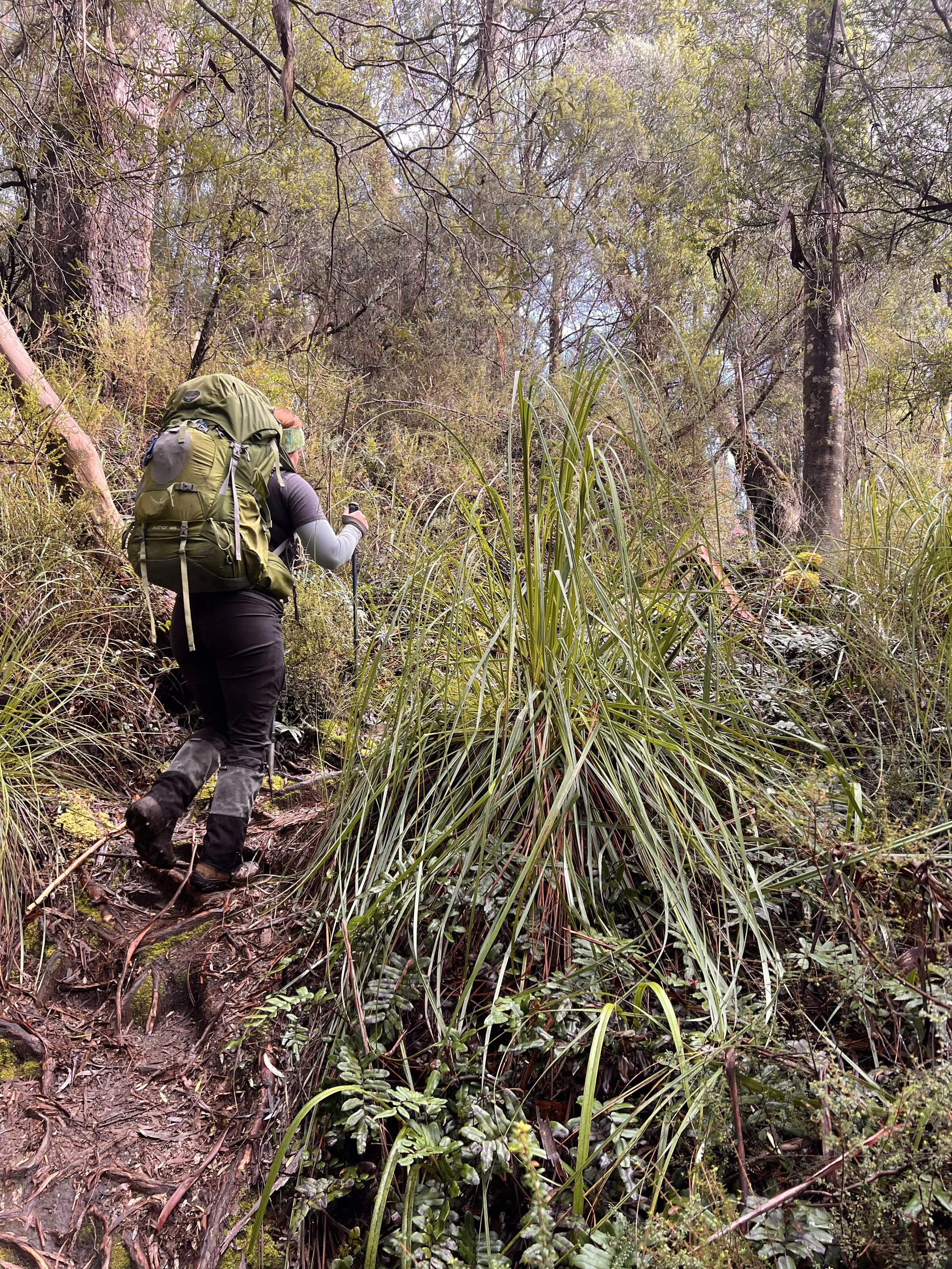
At about 11.5km in, the trail begins to climb for just over 200m of elevation. The climb goes through myrtle rainforest with celery top pines, sassafras, mud and plenty of tree roots!
On reaching the top of the climb there is just under 1km to go until we reach Lake Vera.
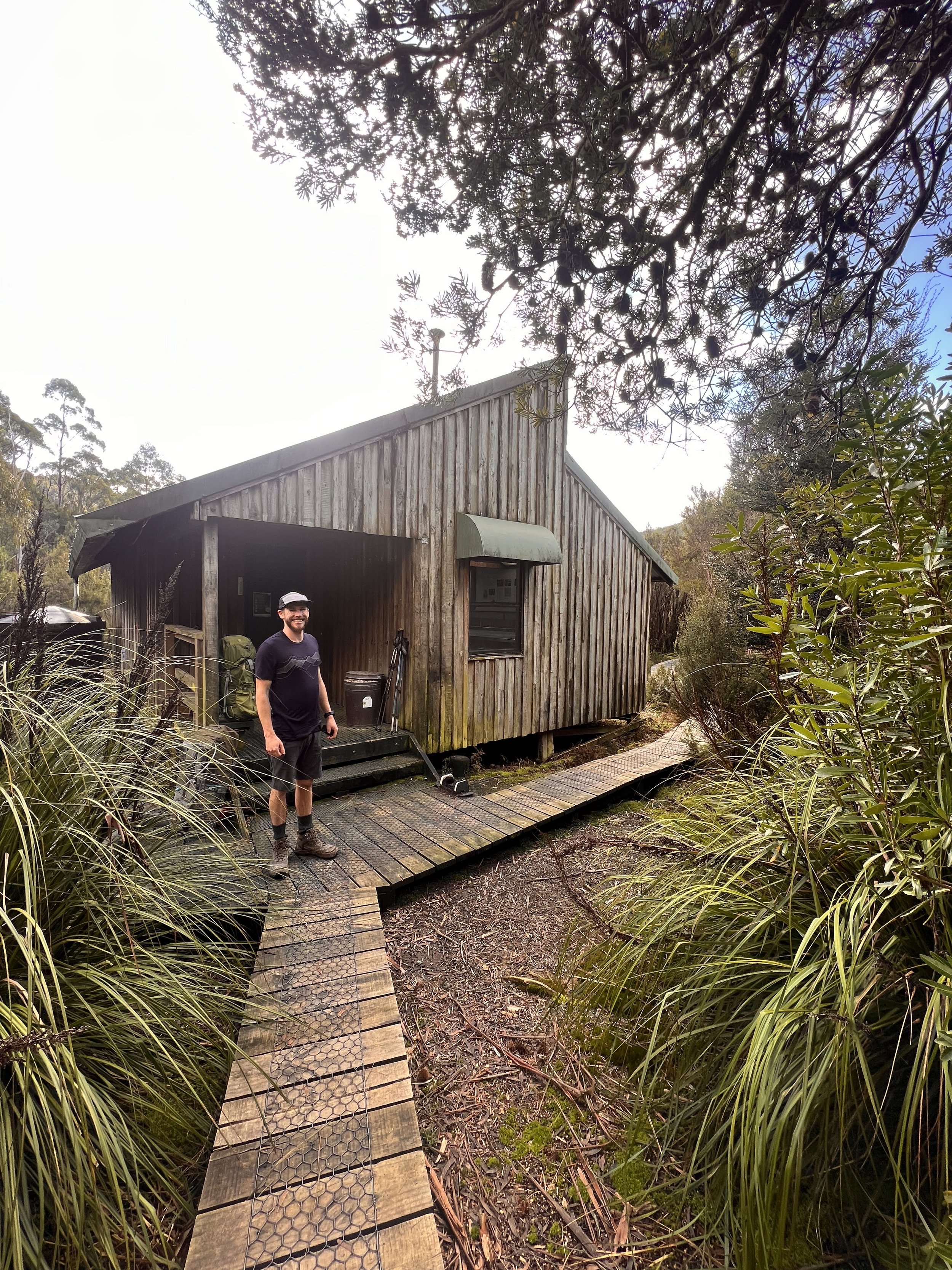
A picturesque hut welcomes us to the Lake Vera camp, with tent platforms out to the right of the hut.
We arrived at about 2.30pm to glorious afternoon sun. We picked a tent platform that was doused in sunshine to lie on and soak up the warmth of the Tassie winter sun.
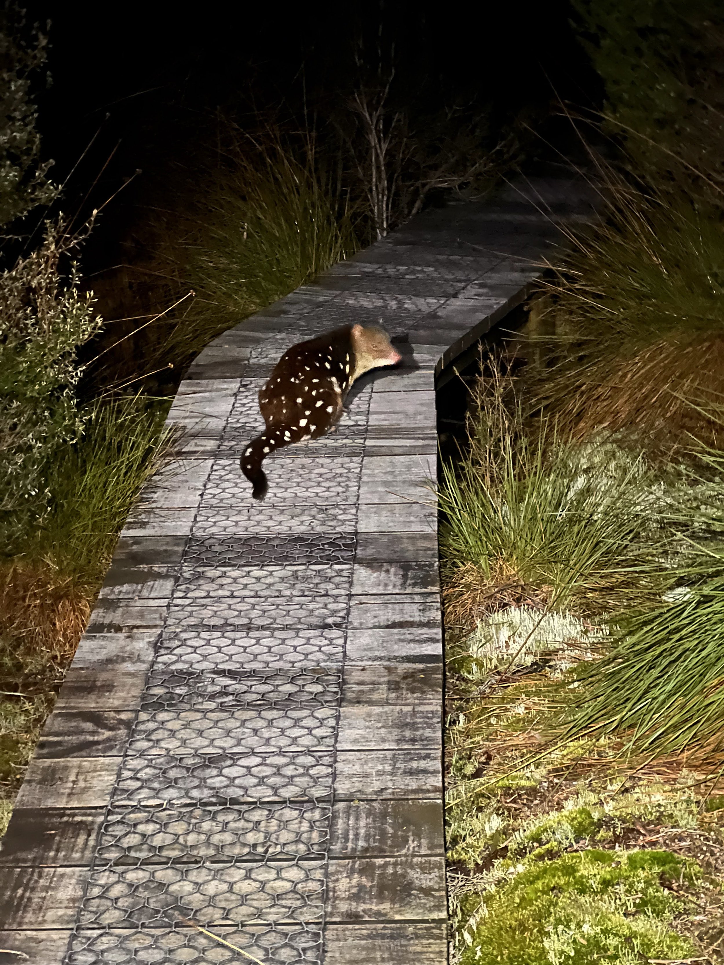
One of the big perks of camping out here was that we had a night time visit from a Spotted Quoll!
Total Distance: 15km
Total Time: 5 hours
Total Climb: 400m
Day 2: Lake Vera to Lake Tahune + Summit Frenchman’s Cap
Knowing that we’re in for a big day today with lots of elevation gain and wanting to make the most of the sunshine while it lasted we set off from camp at 7.30am.
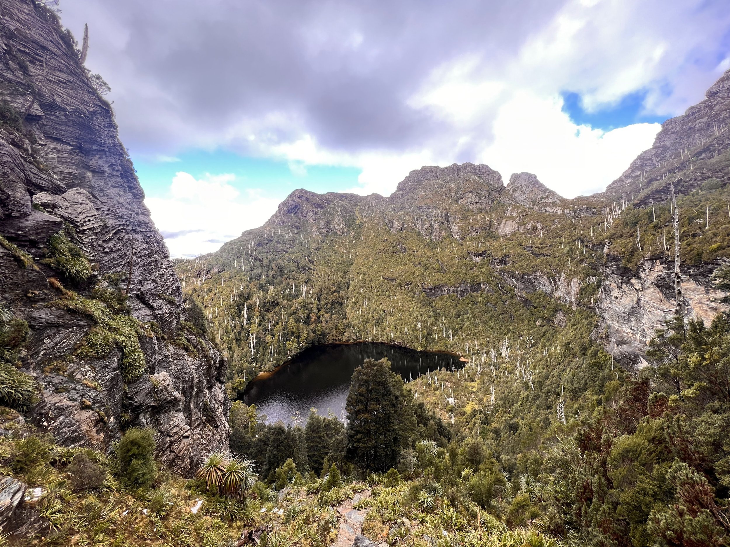
The trail winds around the Northern edge of Lake Vera through rainforest dotted with Huon Pines. Views out to the lake were spectacular, the water was like glass.. we definitely had the perfect day!
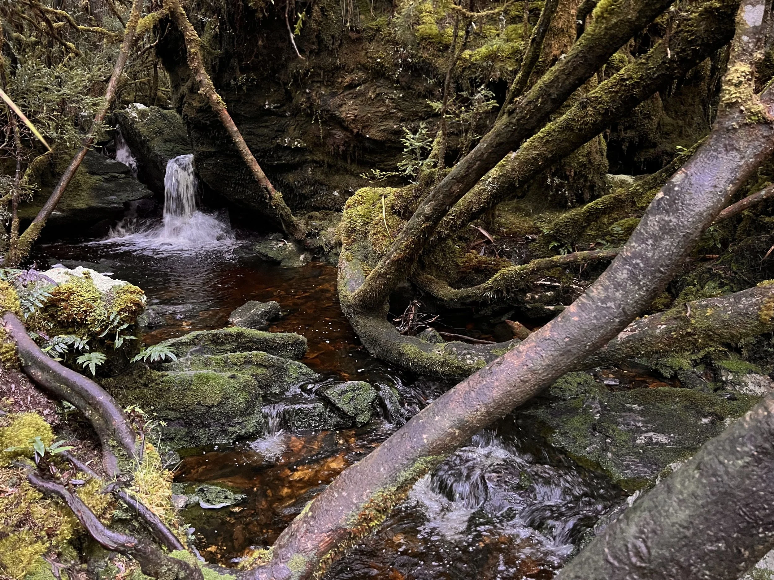
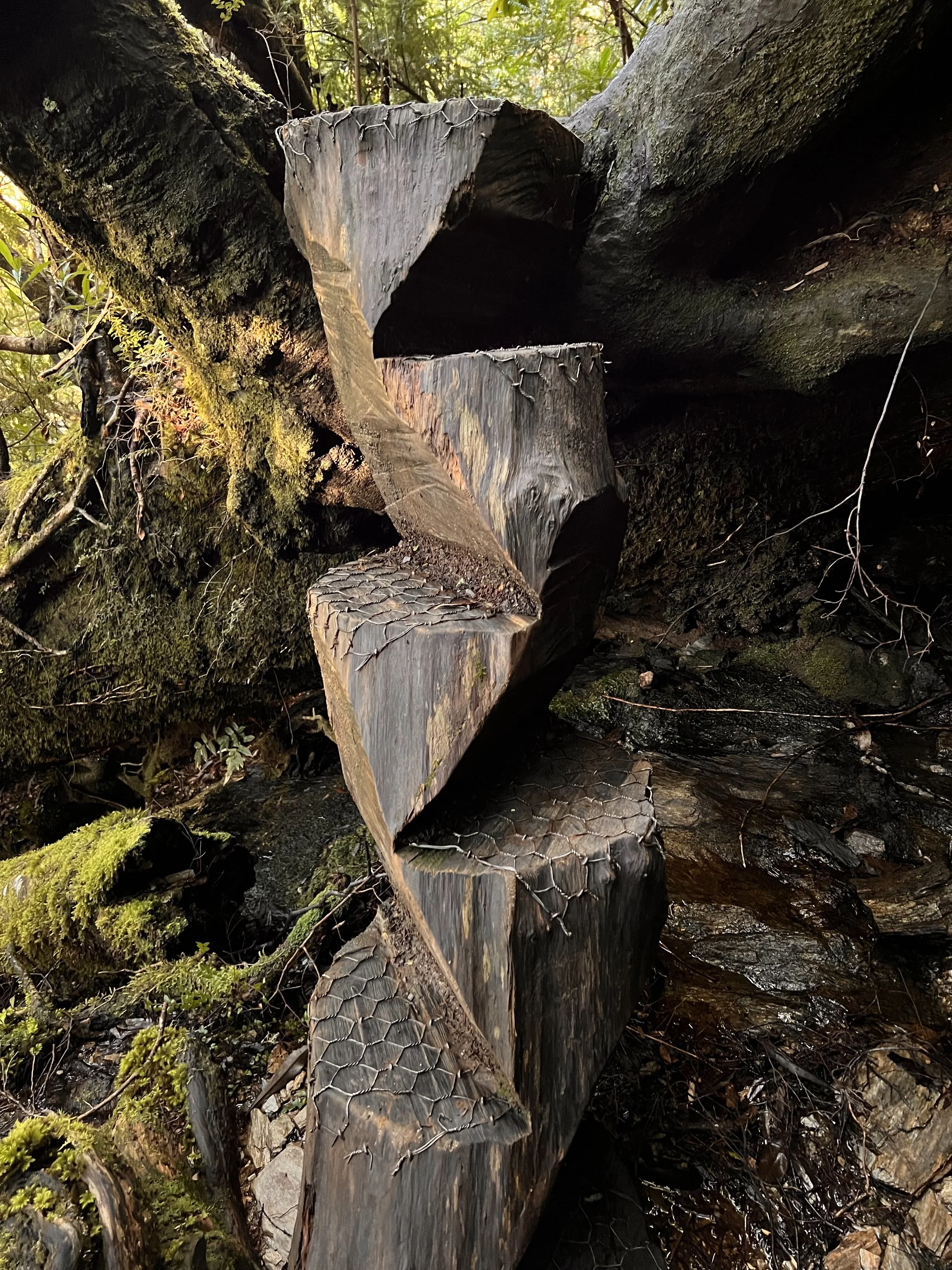
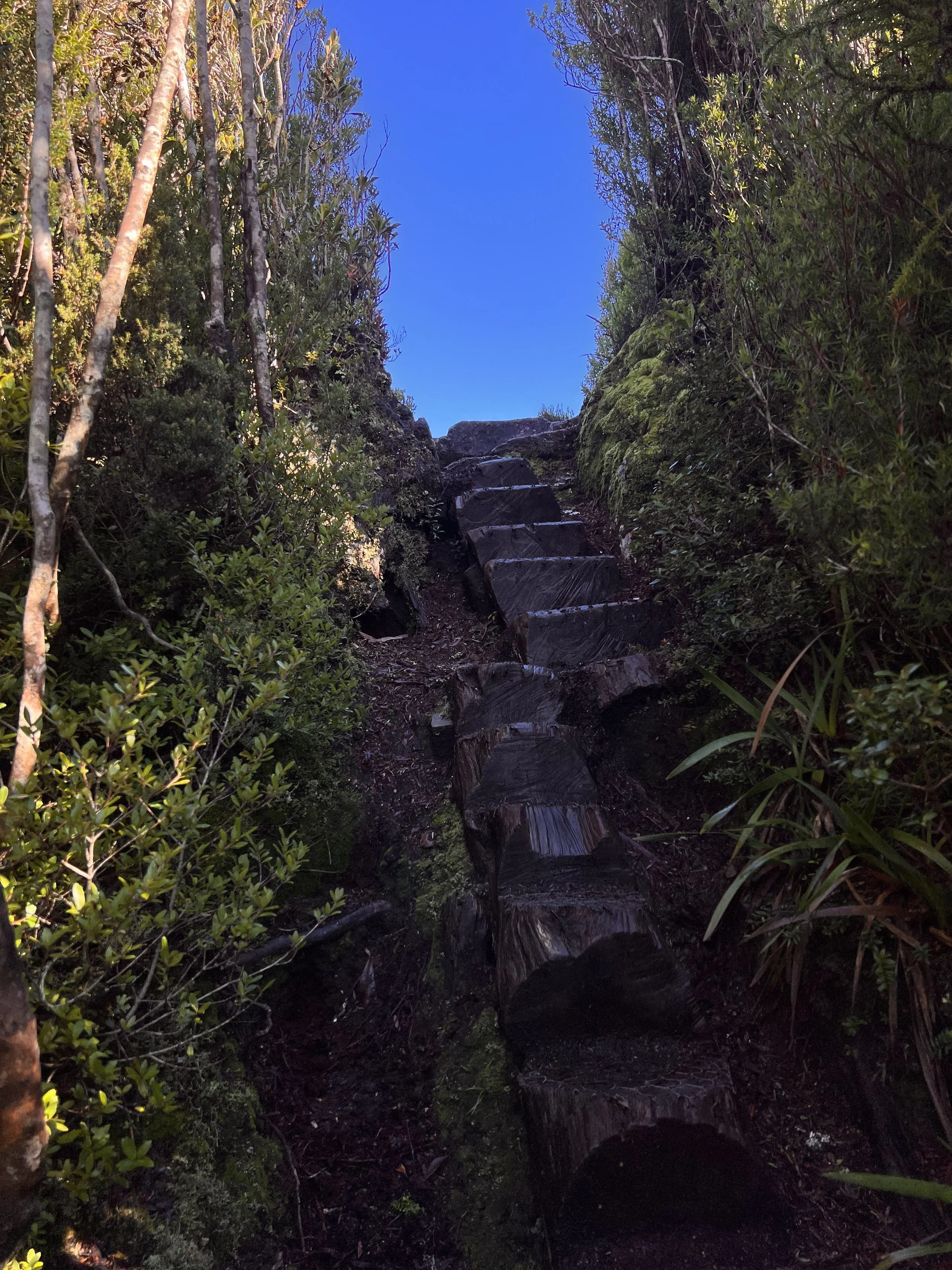
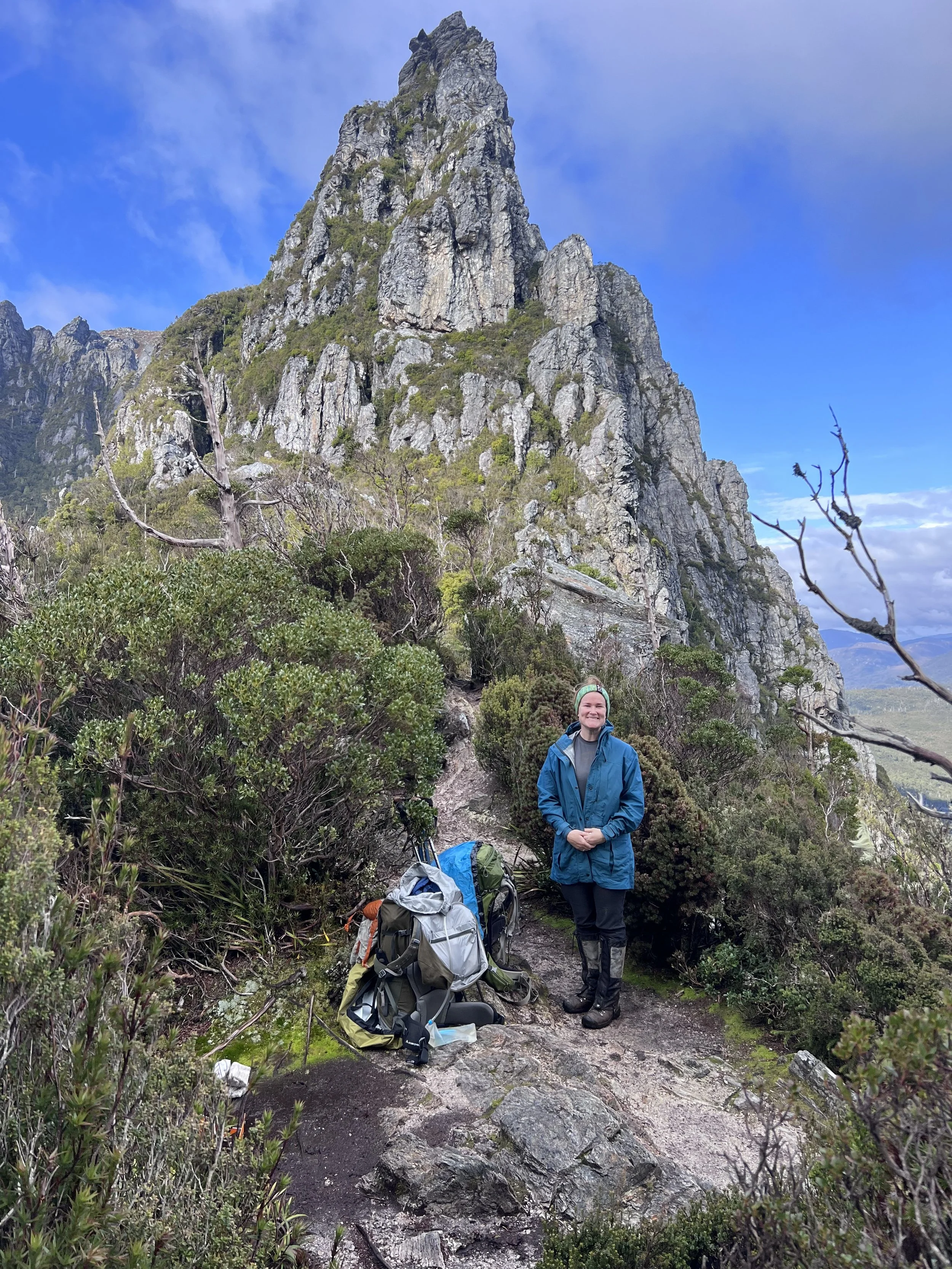
Once around the Lake the climb up to Barron Pass begins. It’s a long climb up but it’s here that I am so captivated by the incredible track work that has been done. Fallen logs cut into makeshift ladders placed over steep banks make the climb lots of fun. Noticing the vegetation change as we hit 800-900m, the big King Billy pines and Pandanus fill the forest. Large, sheer cliff faces and fallen boulders that create amazing water features and caves.. all of this helps to distract from the physical exertion of climbing up to the pass.

You know you’ve almost reached the top when all of the sudden, climbing up one of those makeshift ladders it looks as though you’ve reached the end of the earth!
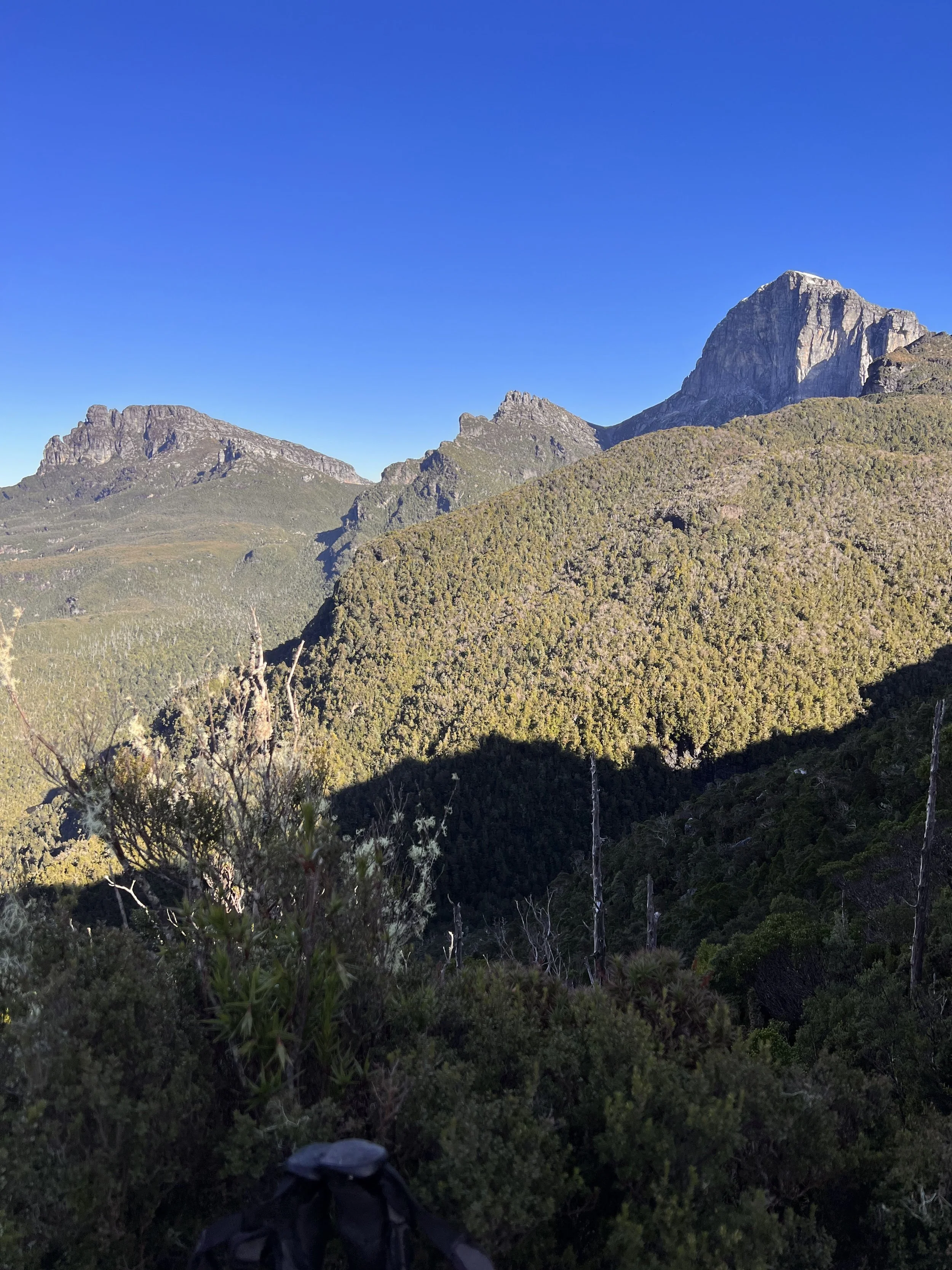
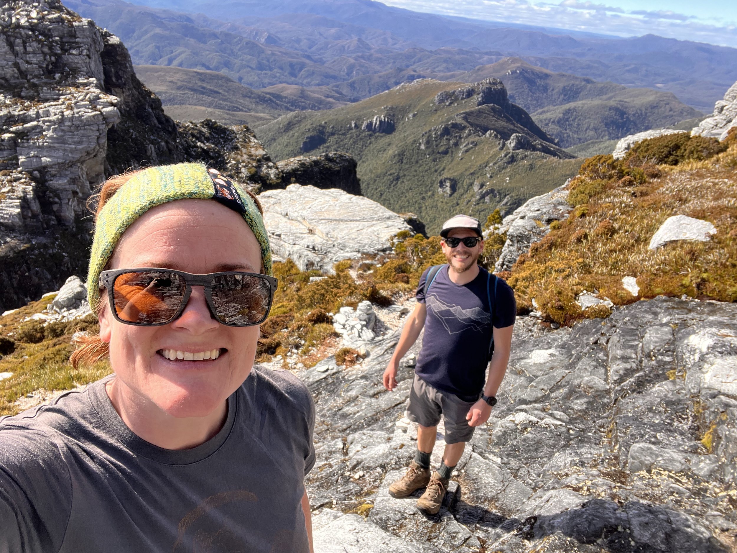
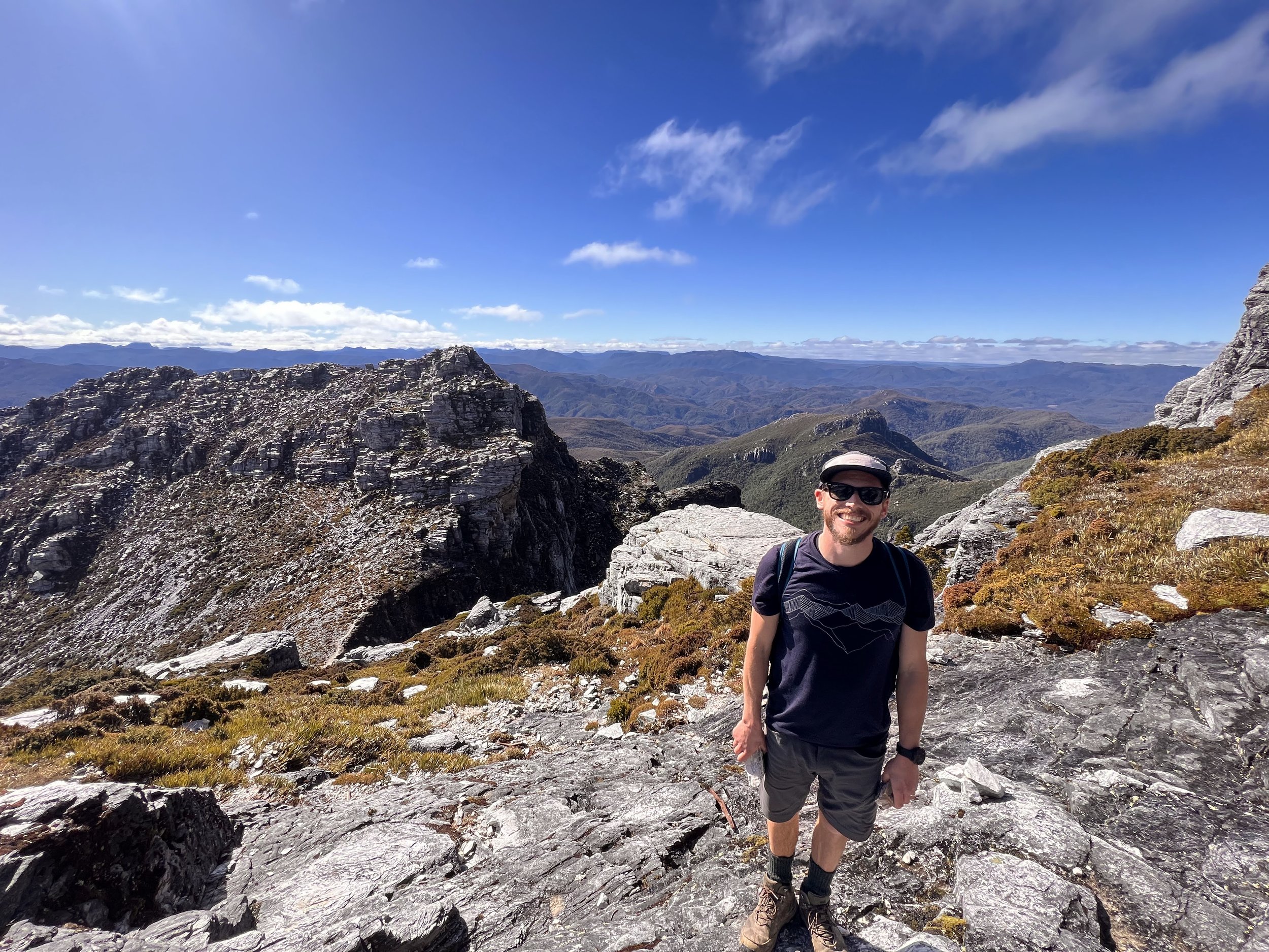
Again, we are awarded with speccy views of Frenchman’s Cap as well as the surrounding Sharlands Peak, Nicoles Needle and White Needle that shoulder Barron Pass. It was 3kms from Lake Vera to Barron Pass and it took us just over 2 hours to get there.
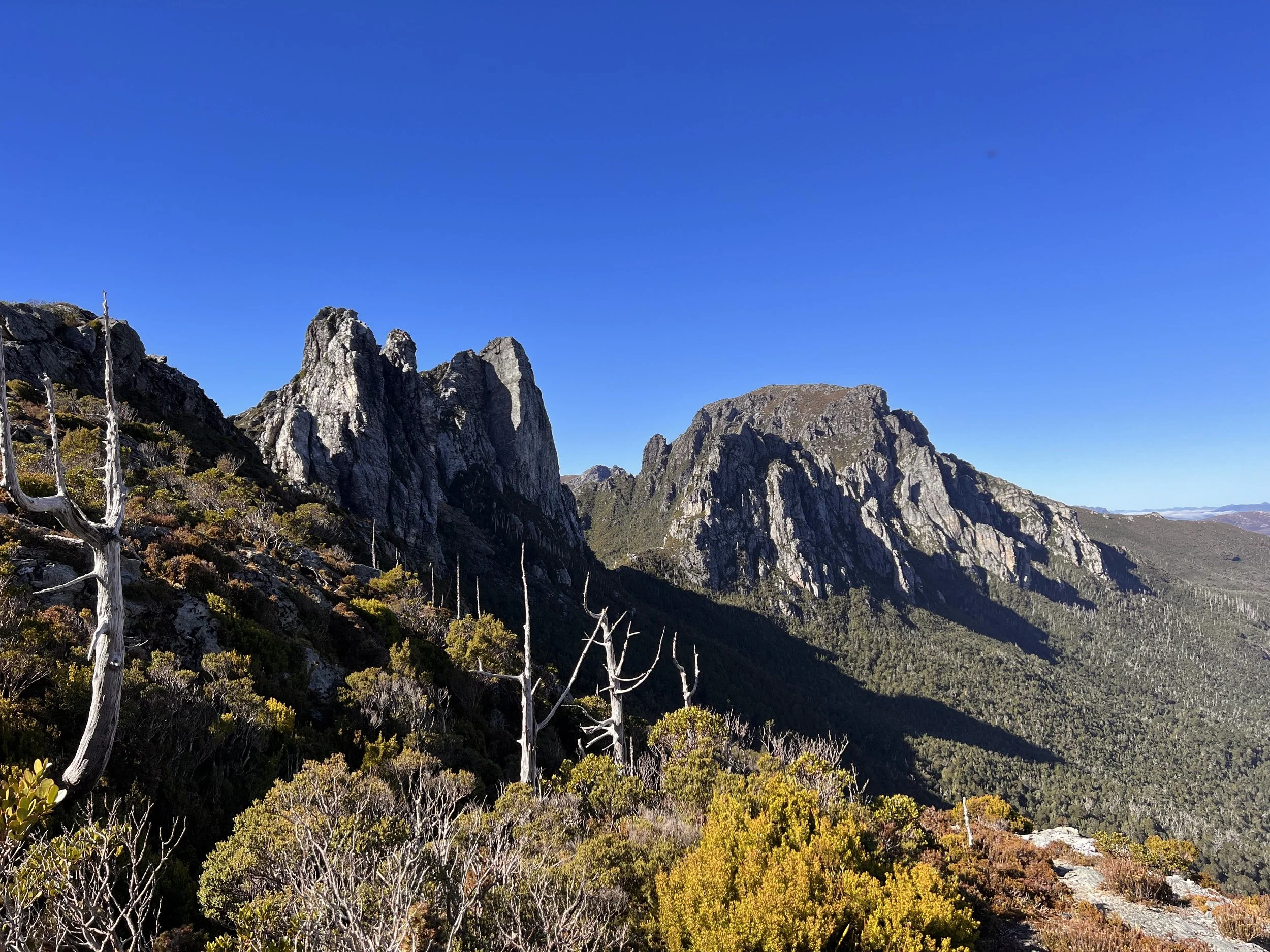
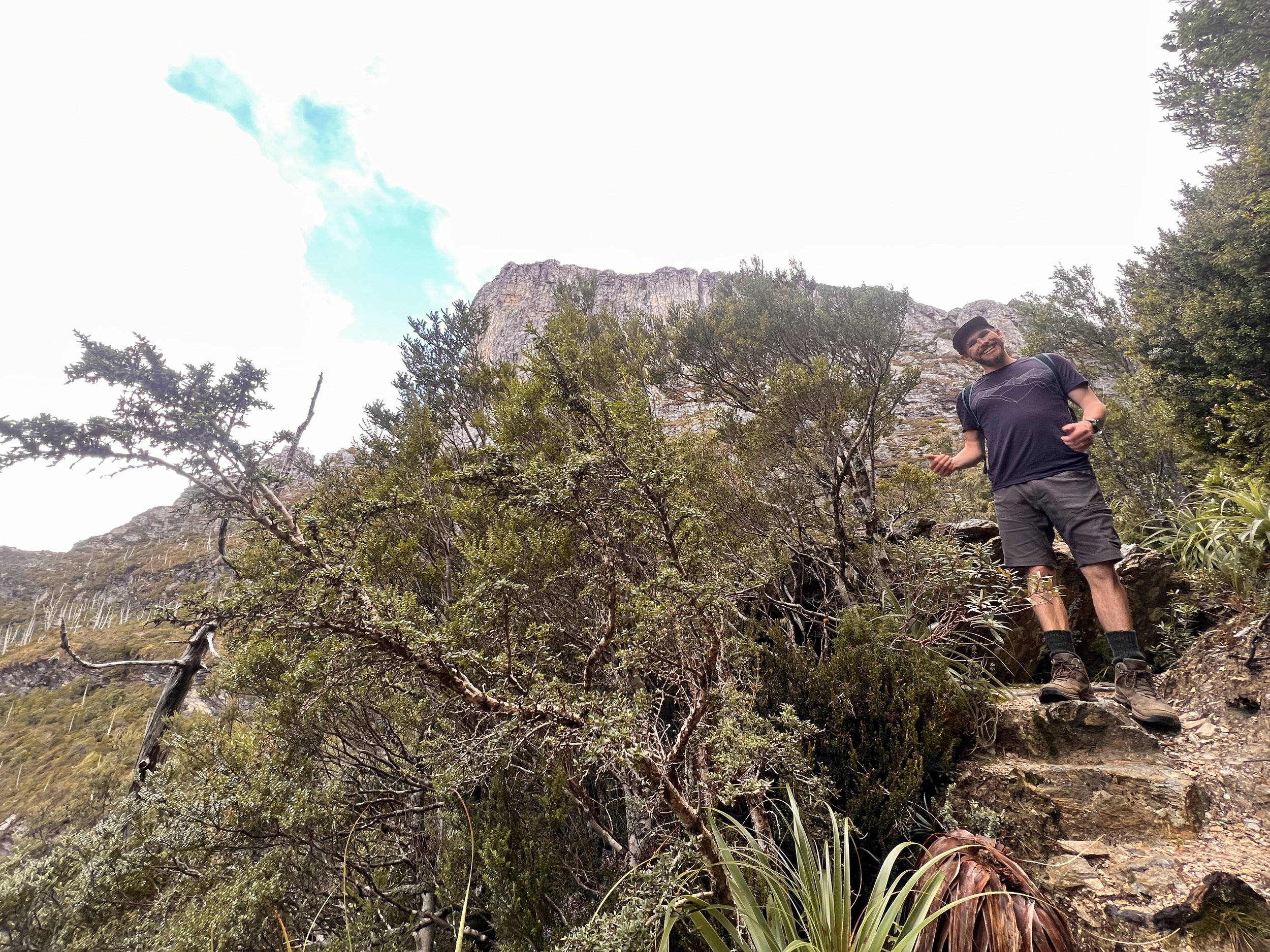
The trail then descends slightly down from the pass and wraps around the edge of Sharlands Peak passing through rocky scree slopes.
Continuing along through Artichoke Valley the trail climbs slightly once more before descending into the stunning Lake Tahune Camp.
We arrived to Lake Tahune at 11.45 and did a very quick gear shuffle to pack a day bag for the summit climb, we decided to have a quick snack and take our lunch up to the top so we could make the most of the views and the sunshine.
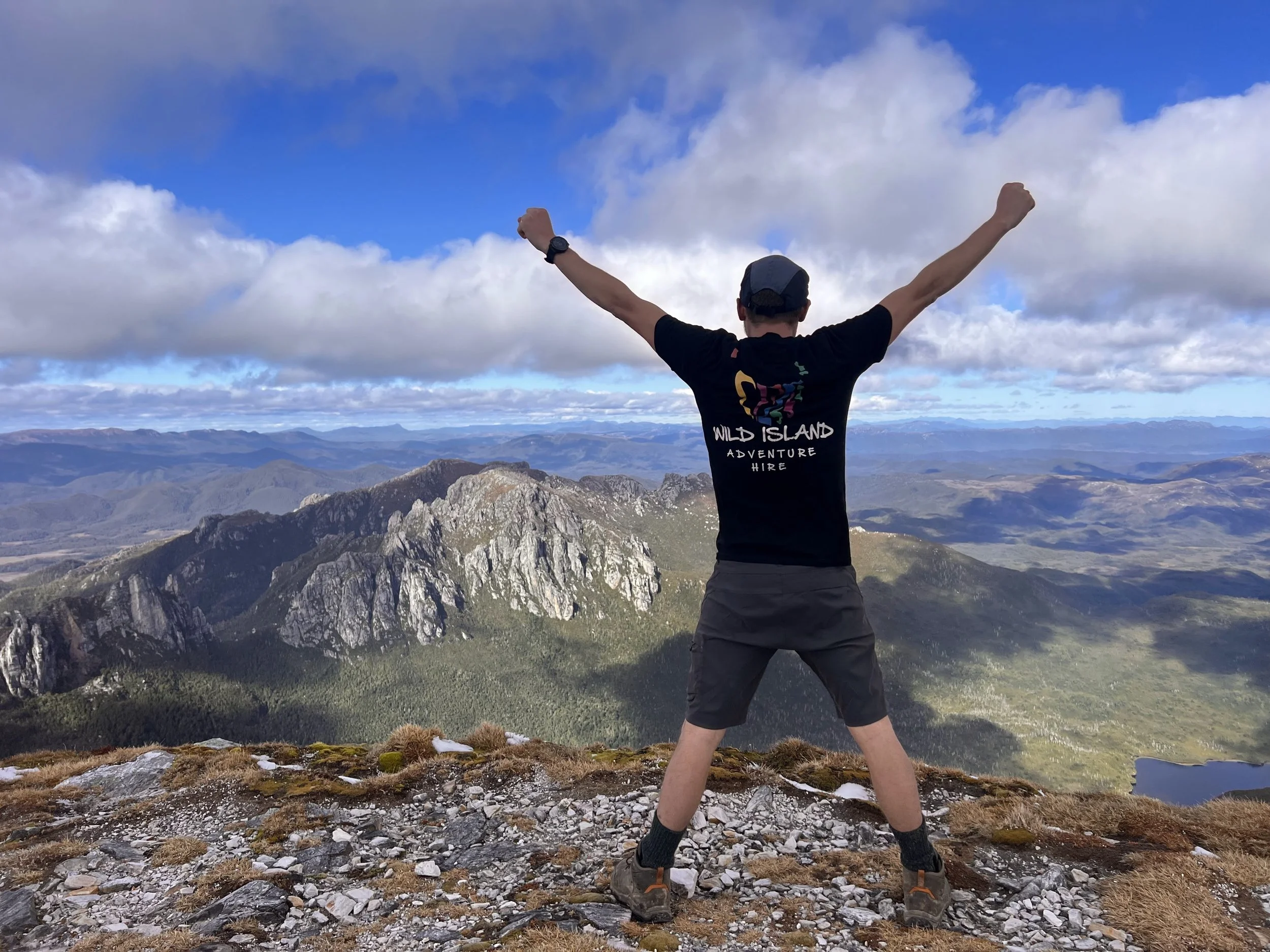
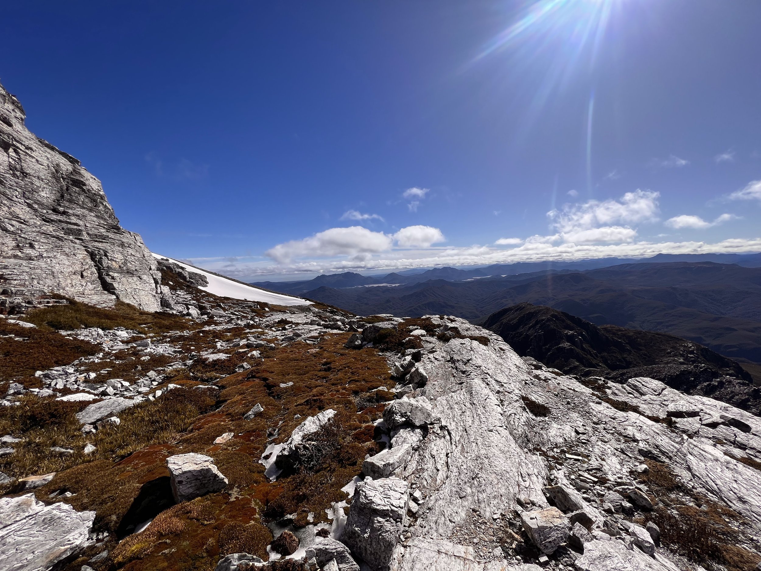
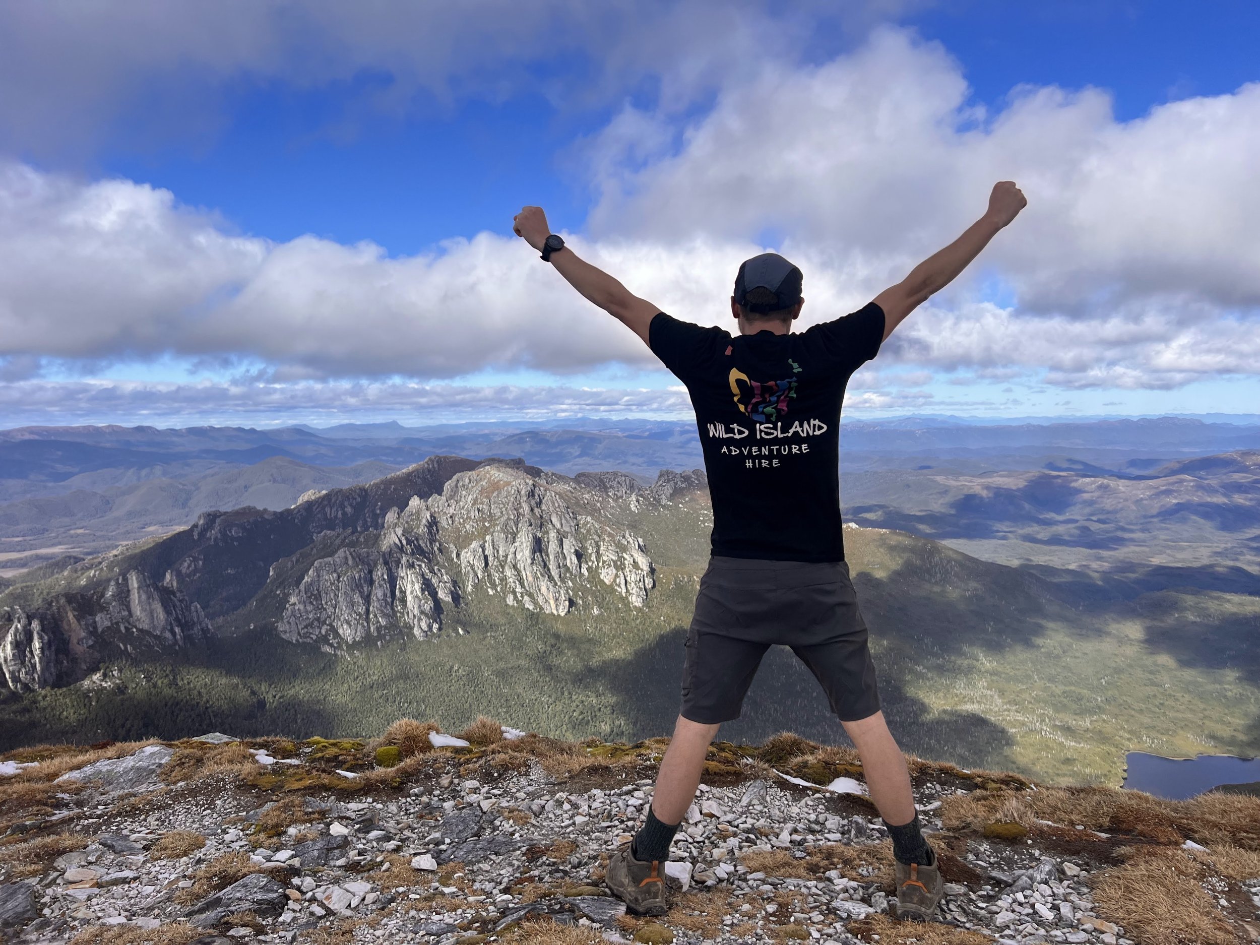
It’s a 500m climb to the summit over a distance of 1.3km. The track weaves its way up towards the saddle between Lion’s Head and Frenchman’s Cap before diverting away from the saddle toward the South to pick up ridge line leading up to the summit. It quickly turns to very low vegetation and rocky terrain before opening up into big slab rocks of quartzite. The views out to the surrounding mountains and landscape are mind-blowing. There are a couple of quite steep, rocky sections that require some thought as to how to approach them but otherwise the trail is fairly straightforward, just steep! After just over an hour we reach the large open summit that is the peak of Frenchman’s Cap. We enjoyed our lunch and the views for about half an hour before we got too cold and started to make our way back down to Lake Tahune for the night.
Total Distance: 7.1km
Total Time: 7 hours
Total Climb: 850m
Day 3: Lake Tahune – Trailhead
Today we were expecting the weather to come in, we had a relaxed morning after a big couple of days and set off at about 9am with no real plan as to where we’d end up. We had enough food to last us a couple more days and decided we’d make up our mind as we reached different options.
Much to our surprise (and extreme gratitude), the weather stayed on our side for most of the day. The walk back to Barron Pass and down to Lake Vera was much gentler with the trajectory being downhill versus up. We were back at Vera before we knew it! Just before the hut a boardwalk out to the right leads to a platform on the edge of the lake so we headed out there for lunch at about 1230pm to enjoy more of the sun.


As it was still early in the day we decided to push on from Lake Vera with the aim to camp at the Loddon River, we knew it would take us about 3 hours which would have us arriving by 4pm. Within 2 hours of leaving Lake Vera the rain started to come down and by the time we reached the Loddon, pretty much bang on 4pm, it had well and truly settled in! We tossed up our options – Option 1: Stay at the Loddon, set up the tent and spend the afternoon sitting in the tent playing cards…. Option 2: Walk the 2 hours out to the car, drive half an hour to the Derwent Bridge Pub, hope to God they’re open and get a pub meal…. we went for option 2 ;-)
So off we trudged, enjoying that feeling of being safe inside your waterproof rain jacket while it pours down around you. I did completely forget about the climb up to Franklin Hills shortly after departing the Loddon so that 200m elevation gain threw me a bit. Before we knew it, we were crossing the Franklin River again and then back at the car.
We zipped down to the pub to find that it was open and enjoyed a lovely meal by the fireplace.
We absolutely love the Derwent Bridge Pub and would highly recommend it to anyone who finds themselves up in the area. The pub itself is incredible and full of history, the meals are just what you want them to be and the staff that work there are just so lovely.
Total Distance: 20km
Total Time: 9 hours
Total Climb: 200m